Search results
From MohidWiki
Create the page "SWAT" on this wiki! See also the search results found.
Page title matches
- Check the documentation in the SWAT link package avilable in the MOHID download center.87 bytes (14 words) - 20:10, 10 July 2009
- ...table has to main functions: i)To help explore SWAT outputs; ii) To Couple SWAT and [[Mohid River Network|MRN]]. SWAT-MOHID uses the following MOHID modules:12 KB (1,821 words) - 11:37, 1 March 2019
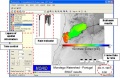
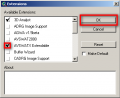
File:Mohid gis swat.JPG ...ults and visualization in MOHID-GIS using the HDF result files produced by SWAT-MOHID (see complete animation in: http://www.mohid.com/Gallery/Swat_HDF_vie(605 × 393 (54 KB)) - 18:11, 31 July 2009- ...f ArcView or [http://www.mapwindow.org/ MapWindow]. This means that to run SWAT interface you need to install any of the softwares. SWAT interface also needs Arcview Spatial Analyst functions, for the Watershed D4 KB (578 words) - 16:04, 15 October 2010
- ...sections, are described the needed steps to be taken in order to perform a SWAT simulation whether using ArcView or MapWindow software. For the ArcView Tutorial see [[Run_SWAT_Model_-_ArcView_Interface | SWAT in ArcView]]420 bytes (61 words) - 15:14, 2 November 2011
File:Swat ArcViewExtension.png (375 × 305 (14 KB)) - 14:03, 17 September 2009
File:Swat NewProject.png (785 × 522 (48 KB)) - 14:31, 17 September 2009
File:Swat WatershedDelin.png (423 × 475 (20 KB)) - 14:48, 17 September 2009
File:Swat Projection.png (409 × 313 (10 KB)) - 15:07, 17 September 2009
File:Swat LandUseSoil.png (641 × 488 (21 KB)) - 17:44, 17 September 2009- ...as_Eutrofizacao\ComoFazer\EstruturaDirectoriasAlbufeiras\1.PreparaInputs\3.SWAT\1.MDT is advised [[Category:SWAT]]2 KB (426 words) - 16:21, 13 October 2010
- ...mat as in \\datacenter\Albufeiras_Eutrofizacao\ComoFazer\1.PreparaInputs\3.SWAT\ExemploAplicacao\data\ValadaPCP.dbf.1 KB (182 words) - 17:38, 24 June 2010
File:SWAT MOHID folders.png (430 × 431 (21 KB)) - 18:30, 3 November 2009
File:SWAT MOHID Subsbasin.png (392 × 434 (14 KB)) - 18:37, 3 November 2009
File:SWAT MOHID Hru.png (285 × 214 (6 KB)) - 18:37, 3 November 2009
File:SWAT MOHID folders1.png (419 × 479 (53 KB)) - 12:28, 4 November 2009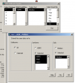
File:Swat GWParameter.png (533 × 591 (20 KB)) - 13:12, 2 March 2010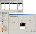
File:Swat SoilParameter.png (634 × 607 (24 KB)) - 13:28, 2 March 2010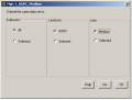
File:Swat MGTParameter2.png (472 × 358 (9 KB)) - 19:09, 2 March 2010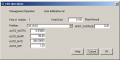
File:Swat MGTParameter.png (533 × 268 (9 KB)) - 19:12, 2 March 2010


Page text matches
- ...ovided by the user and water uptake is simulated. The second option uses a SWAT based vegetation growth model and plant biomass, LAI, nutrient content and SWAT vegetation growth model uses the concepts from EPIC crop model (Izaurralde66 KB (6,709 words) - 16:40, 28 March 2017
- ..., kill, fertilization, pesticide application, etc.) including dormancy and SWAT crop database ...RiverNetwork.F90 MOHID RiverNetwork] Program that alows to run river using SWAT-Mohid discharges9 KB (1,268 words) - 12:53, 12 October 2017
- *[[SWAT Link]]2 KB (171 words) - 10:40, 7 October 2019
- > sudo apt-get install smbfs smbclient samba samba-tools swat smb2www xsmbrowser2 KB (242 words) - 11:57, 18 May 2010
- [[Mohid SWAT | MOHID SWAT]]2 KB (240 words) - 10:27, 11 April 2018
- Discharges into MOHID River Network can be automatically linked to SWAT model discharges; see description in SWATLink download package in www.mohid11 KB (1,634 words) - 15:08, 29 March 2023
- * Chambel-Leitão P. (2008) Load and flow estimation: HARP-NUT guidelines and SWAT model description. In Perspectives on Integrated Coastal Zone Management in .... (2008) Estimation of loads in the Aysén Basin of the Chilean Patagonia: SWAT model and Harp-Nut guidelines. In Perspectives on Integrated Coastal Zone M4 KB (716 words) - 14:47, 20 March 2009
- ...itly because this uptake may be disconnected from evapotranspiration flux (SWAT formulation).18 KB (2,109 words) - 16:14, 7 February 2019
- Check the documentation in the SWAT link package avilable in the MOHID download center.87 bytes (14 words) - 20:10, 10 July 2009
- ...table has to main functions: i)To help explore SWAT outputs; ii) To Couple SWAT and [[Mohid River Network|MRN]]. SWAT-MOHID uses the following MOHID modules:12 KB (1,821 words) - 11:37, 1 March 2019
File:Mohid gis swat.JPG ...ults and visualization in MOHID-GIS using the HDF result files produced by SWAT-MOHID (see complete animation in: http://www.mohid.com/Gallery/Swat_HDF_vie(605 × 393 (54 KB)) - 18:11, 31 July 2009- ====Run SWAT Model for river inputs==== ...both flow and concentrations at the same time is very limited, we will use SWAT as the model for boundary river simulation. The field data when exists will32 KB (5,188 words) - 16:16, 2 November 2011
- ...f ArcView or [http://www.mapwindow.org/ MapWindow]. This means that to run SWAT interface you need to install any of the softwares. SWAT interface also needs Arcview Spatial Analyst functions, for the Watershed D4 KB (578 words) - 16:04, 15 October 2010
- ...sections, are described the needed steps to be taken in order to perform a SWAT simulation whether using ArcView or MapWindow software. For the ArcView Tutorial see [[Run_SWAT_Model_-_ArcView_Interface | SWAT in ArcView]]420 bytes (61 words) - 15:14, 2 November 2011
- ...as_Eutrofizacao\ComoFazer\EstruturaDirectoriasAlbufeiras\1.PreparaInputs\3.SWAT\1.MDT is advised [[Category:SWAT]]2 KB (426 words) - 16:21, 13 October 2010
- ...mat as in \\datacenter\Albufeiras_Eutrofizacao\ComoFazer\1.PreparaInputs\3.SWAT\ExemploAplicacao\data\ValadaPCP.dbf.1 KB (182 words) - 17:38, 24 June 2010
- #Compare Vegetation growth and erosion with SWAT in subbasin of Save and Enxoe #Article 2 - SWAT and Mohid Land6 KB (938 words) - 10:54, 29 February 2012
- ...ógicos y de contaminación por nitratos mediante dos códigos numéricos (SWAT y MOHID). Cuenca agrícola del río Alegría (País Vasco). PhD thesis. Uni Demissie GA (2010). Integrated sediment transport modelling using SWAT-MOHID models in the Lake Tana subbasin, Upper Blue Nile, Ethiopia. MSc diss261 KB (37,509 words) - 23:24, 1 April 2024
- !IF THIS IS ZERO (0) SWAT RUNS EXACTLY LIKE THE ORIGINAL ONE. IF IT IS ONE (1) THE MODIFED VERSION IS3 KB (402 words) - 11:44, 1 March 2019
- ==SWAT Project and first simulation with default parameters== ===Create the SWAT Project===19 KB (3,238 words) - 15:56, 2 November 2011